

Tour Type
Mountain Climbing
Tour Duration
10 Days 9 Nights
Min. No of Pax
1
Tour Price
Budget
On request
Mid-range
On request
Luxury
On request
The Price Includes
- Airport pickup from Kilimanjaro International Airport
- Airport transfer on the departure day
- Two nights of hotel accommodation in Arusha
- Bed and breakfast at the hotel in Arusha
- Private transfer from Arusha to Londorossi Gate
- Transfer from Londorossi Gate to the Lemosho trailhead where required
- Transfer from Mweka Gate back to Arusha
- Kilimanjaro National Park conservation fees
- Kilimanjaro National Park camping fees
- Kilimanjaro rescue fees
- Official park entry and exit arrangements
- Professional and licensed Kilimanjaro mountain guide
- Assistant mountain guides according to group size
- Professional mountain chef
- Porters for group equipment and permitted personal luggage
- Mountain crew salaries
- Three meals per day while trekking
- Drinking water during the mountain expedition
- Mountain tents shared by two climbers unless a single tent is arranged
- Dining tent, tables, and chairs
- Cooking equipment and group camping equipment
- Food preparation and camp services
- Basic first aid support carried by the mountain team
- Regular general health and altitude monitoring
- Pre climb briefing in Arusha
- Personal equipment inspection before departure
- Government taxes applicable to the confirmed package
- Summit certificate issued to eligible climbers by park authorities
The Price Excludes
- International flights to and from Tanzania
- Domestic flights unless specifically included
- Tanzania entry visa
- Passport expenses
- Travel and medical insurance
- High altitude trekking and emergency evacuation insurance
- Personal trekking clothing and equipment
- Sleeping bag unless specifically included
- Trekking poles unless specifically included
- Personal daypack and duffel bag
- Personal medication and medical consultations
- Vaccinations and health certificates
- Meals at the hotel other than those stated in the itinerary
- Alcoholic beverages and bottled soft drinks
- Laundry services
- Telephone calls and internet expenses
- Personal shopping and souvenirs
- Additional hotel nights caused by flight changes or personal decisions
- Optional tours and activities in Arusha
- Safari or Zanzibar extensions
- Tips for mountain guides, assistant guides, chefs, and porters
- Costs caused by illness, evacuation, itinerary changes, or early descent
- Replacement of lost or damaged personal equipment
- Services not clearly mentioned under the price inclusion section
Tour Overview
The 10 Days Lemosho Route with 8 Days Hiking is one of the most scenic, carefully paced, and rewarding ways to climb Mount Kilimanjaro. Designed for travelers seeking excellent acclimatization, varied landscapes, quieter opening trails, and an unforgettable journey to the highest point in Africa, this itinerary combines eight days of mountain trekking with an arrival day and a departure day in Tanzania.
Your adventure is organized by Woodland Trek & Safaris, a professional Tanzania tour company based in Arusha, Tanzania. From the moment you arrive at Kilimanjaro International Airport until your final airport transfer, our mountain team coordinates the essential details required for a safe, comfortable, and memorable Kilimanjaro climbing experience.
Mount Kilimanjaro rises to 5,895 metres or 19,341 feet above sea level at Uhuru Peak. It is the highest mountain in Africa and one of the most iconic high altitude trekking destinations in the world. Although reaching the summit does not normally require technical rock climbing skills, the journey remains physically demanding because of the altitude, changing weather, long trekking days, cold temperatures, and the endurance required during summit night.
The Lemosho Route begins on the remote western side of Mount Kilimanjaro. Its early stages pass through beautiful montane rainforest before climbing toward the heath and moorland zone. The trail then crosses the enormous Shira Plateau, one of the most remarkable volcanic landscapes on Kilimanjaro, before joining the southern circuit beneath the ice covered summit of Kibo.
As you continue around the mountain, the trail leads through the alpine desert toward Lava Tower, Barranco Valley, the famous Barranco Wall, Karanga Camp, and Barafu Camp. The final ascent begins around midnight and takes you through the darkness toward Stella Point and ultimately Uhuru Peak, the highest point on the African continent.
The eight day Lemosho climbing schedule is especially attractive because it provides more time for gradual altitude adaptation than shorter Kilimanjaro itineraries. The route follows the important mountaineering principle of gaining altitude gradually and, on selected days, climbing high before sleeping at a lower elevation. This approach gives your body more time to adjust to reduced oxygen levels.
The route also offers extraordinary ecological diversity. During a single expedition, you travel through environments that resemble a journey from tropical Africa to the polar regions. The lower trail is surrounded by fertile rainforest, giant ferns, moss covered trees, wildflowers, and dense undergrowth. Higher elevations reveal open heathland, giant groundsels, volcanic ridges, rocky valleys, alpine desert, glaciers, and the exposed arctic environment surrounding the summit.
Kilimanjaro National Park protects approximately 1,712 square kilometres of mountain wilderness. The mountain contains three major volcanic formations known as Shira, Mawenzi, and Kibo. Shira is the oldest formation and now forms a broad plateau. Mawenzi is recognised by its dramatic and rugged peaks, while Kibo is the highest volcanic cone and holds Uhuru Peak.
The 10 day itinerary begins with your arrival in Arusha, where you meet the Woodland Trek & Safaris team, receive a detailed mountain briefing, review your equipment, and prepare for the climb. The following morning, you travel to Londorossi Gate and the Lemosho trailhead to begin eight days of hiking.
Your mountain journey concludes at Mweka Gate after descending through the rainforest. You will then return to your hotel for a warm shower, rest, and celebration before departing Tanzania on the tenth day or continuing with a Tanzania safari, Zanzibar beach holiday, or another African adventure.
This itinerary is recommended for adventurous travelers with good general fitness, determination, a positive attitude, and sufficient time to prepare. Previous technical mountaineering experience is not normally required, but regular walking, cardiovascular training, leg strengthening, and mental preparation are strongly recommended.
Throughout the expedition, you will be supported by an experienced mountain crew that may include a lead guide, assistant guides, a mountain chef, and porters. The team prepares meals, carries group equipment, establishes camps, monitors your general condition, and encourages a slow, steady rhythm known locally as pole pole, meaning slowly, slowly in Swahili.
The journey is about much more than reaching the summit. It is an opportunity to disconnect from everyday routines, test your resilience, walk through ancient volcanic landscapes, build friendships with your mountain team, and experience the rare silence found high above the clouds.
When you finally stand at Uhuru Peak and watch the morning light spread across the glaciers, volcanic crater, and distant plains of Tanzania, the long preparation and challenging ascent become part of an achievement you may remember for the rest of your life.
Essential Kilimanjaro Trip Information
- Tour duration: 10 days and 9 nights
- Mountain trekking duration: 8 days and 7 nights
- Starting point: Arusha, Tanzania
- Starting trail: Lemosho Route on the western side of Mount Kilimanjaro
- Mountain entrance: Londorossi Gate and Lemosho trailhead
- Mountain exit: Mweka Gate
- Highest point: Uhuru Peak at 5,895 metres or 19,341 feet
- Accommodation on the mountain: Designated public campsites
- Accommodation before and after the climb: Hotel accommodation in Arusha
- Estimated total trekking distance: Approximately 65 to 72 kilometres, depending on campsite positioning and optional acclimatization walks
- Difficulty level: Challenging high altitude trek
- Technical climbing requirement: No technical climbing is normally required on the standard trail
- Recommended fitness level: Good general fitness with previous hiking preparation
- Main landscapes: Montane rainforest, heath and moorland, Shira Plateau, alpine desert, volcanic valleys, glaciers, and arctic summit terrain
- Main summit: Uhuru Peak on Kibo
- Best suited for: Travelers who prefer a scenic route with a gradual climbing schedule and more time for acclimatization
Day To day
Day 1: Arrival at Kilimanjaro International Airport and Transfer to Arusha
Location: Kilimanjaro International Airport and Arusha
Approximate driving distance: 50 to 55 kilometres
Approximate transfer time: 1 to 1.5 hours
Elevation in Arusha: Approximately 1,400 metres or 4,593 feet
Main activities: Airport reception, hotel transfer, Kilimanjaro briefing, equipment inspection, and preparation
Welcome to Tanzania, the home of Mount Kilimanjaro and the beginning of your unforgettable journey to the Roof of Africa. Upon arrival at Kilimanjaro International Airport, you will be welcomed by a representative from Woodland Trek & Safaris. After collecting your luggage and completing the airport arrival procedures, you will begin the drive to your hotel in Arusha.
The journey from Kilimanjaro International Airport to Arusha normally takes approximately one to one and a half hours, depending on traffic and the location of your accommodation. Along the way, you may see fertile farmland, local settlements, coffee plantations, distant hills, and, when weather conditions are clear, beautiful views of Mount Kilimanjaro or Mount Meru.
Arusha is widely recognised as one of Tanzania’s leading tourism centres. The city is positioned near several major attractions, including Arusha National Park, Mount Meru, Tarangire National Park, Lake Manyara National Park, Ngorongoro Conservation Area, and the Serengeti ecosystem. Its strategic location also makes it an important preparation point for Mount Kilimanjaro expeditions.
After checking into your hotel, you will have time to rest and recover from your flight. Later, you will meet your Kilimanjaro guide or mountain representative for a detailed pre climb briefing. The guide will explain the daily programme, expected weather conditions, campsite procedures, health monitoring, mountain safety, meal arrangements, summit preparation, and the responsibilities of the climbing team.
Your personal trekking equipment will also be inspected. This step helps identify missing, unsuitable, or insufficient items before you enter the national park. Particular attention is given to hiking boots, warm summit clothing, waterproof layers, sleeping bags, gloves, headlamps, personal medication, hydration systems, and duffel bags.
You will then organise your mountain luggage and separate any belongings that you do not need during the climb. Unnecessary luggage can normally be stored securely at the hotel until you return from the mountain.
The rest of the evening is dedicated to relaxation, hydration, and mental preparation. You are encouraged to eat a balanced meal, drink sufficient water, and sleep early before the first hiking day.
Additional Activities Available in Arusha
- Visit a local craft and souvenir market
- Explore the Cultural Heritage Centre
- Enjoy an optional Arusha city tour
- Visit a nearby coffee estate
- Purchase or rent missing trekking equipment
- Exchange currency for personal expenses and mountain tips
- Rest at the hotel and recover from international travel
- Attend a private equipment consultation with the mountain team
Accommodation: Hotel in Arusha
Meal plan: Bed and breakfast
Day 2: Arusha to Londorossi Gate and Trek to Mti Mkubwa Camp
Starting location: Arusha
Mountain entrance: Londorossi Gate and Lemosho trailhead
Destination: Mti Mkubwa Camp
Approximate driving distance: 150 to 180 kilometres
Approximate driving time: 3.5 to 4.5 hours
Approximate trekking distance: 6 kilometres
Approximate trekking time: 3 to 4 hours
Starting elevation at the trailhead: Approximately 2,360 metres or 7,742 feet
Sleeping elevation: Approximately 2,895 metres or 9,498 feet
Vegetation zone: Montane rainforest
Main activities: National park registration, forest trekking, wildlife observation, birdwatching, and camping
After an early breakfast at your hotel, you will meet your guide and mountain crew before leaving Arusha for the western side of Mount Kilimanjaro. The drive passes through changing landscapes that may include local communities, cultivated farmland, open countryside, and forested mountain slopes.
Your first major stop is Londorossi Gate, one of the official entrances to Kilimanjaro National Park. The gate lies on the western side of the mountain and serves as the registration and administrative point for climbers using the Lemosho and Shira approaches.
At Londorossi Gate, your guide completes the required national park registration procedures while the mountain crew organises food, camping equipment, porter loads, and group supplies. The registration period can take some time, especially during busy climbing seasons, but it is an important part of ensuring that every climber and mountain crew member is recorded correctly.
After completing the gate procedures, you normally continue by vehicle toward the Lemosho trailhead. The final section of the road may be uneven or muddy during periods of rainfall. Upon reaching the trailhead, you meet the full mountain team, receive a final trail briefing, and begin walking through the montane rainforest.
The first hike covers approximately 6 kilometres and normally takes between three and four hours. The trail climbs gradually beneath a thick canopy of ancient trees, hanging mosses, giant ferns, and dense mountain vegetation. The forest floor can be damp, and sections of the trail may become slippery after rainfall.
This rainforest forms an important ecological belt around Mount Kilimanjaro. The lower mountain receives more moisture than the upper slopes, creating a rich habitat for plants, birds, insects, and mammals. Wildlife sightings cannot be guaranteed, but you may hear or occasionally see blue monkeys, black and white colobus monkeys, forest birds, small antelopes, or signs of larger animals moving through remote areas.
Your guide will establish a comfortable walking rhythm from the beginning. On Kilimanjaro, speed is less important than consistency. Walking slowly conserves energy, supports acclimatization, and allows you to enjoy the natural surroundings.
You arrive at Mti Mkubwa Camp, also called Big Tree Camp, in the late afternoon. The camp is situated within the forest at approximately 2,895 metres above sea level. Your tents will normally be prepared by the crew before your arrival.
After settling into camp, you may receive warm drinks and a light snack. Dinner will be served later in the dining tent. Your guide will conduct a short briefing about the following day and may check how you are responding to the first increase in altitude.
Additional Experiences at Mti Mkubwa Camp
- Guided identification of rainforest plants and trees
- Birdwatching around the campsite
- Forest and landscape photography
- Short supervised walk near the camp
- Introduction to the mountain crew
- Evening discussion about Kilimanjaro’s vegetation zones
- Stretching and recovery exercises
- Early evening rest in preparation for the next climb
Accommodation: Mti Mkubwa Camp
Meal plan: Breakfast, lunch, and dinner
Day 3: Mti Mkubwa Camp to Shira 1 Camp
Starting point: Mti Mkubwa Camp
Destination: Shira 1 Camp
Approximate trekking distance: 8 kilometres
Approximate trekking time: 5 to 6 hours
Starting elevation: Approximately 2,895 metres or 9,498 feet
Sleeping elevation: Approximately 3,505 metres or 11,500 feet
Elevation gain: Approximately 610 metres
Vegetation zones: Rainforest, heath, and moorland
Main activities: Forest ascent, moorland trekking, ridge climbing, Shira Plateau views, and acclimatization
After breakfast at Mti Mkubwa Camp, you begin the second trekking day of your Lemosho Route adventure. Today’s trail leaves the dense montane rainforest and enters the more open heath and moorland environment.
The hike covers approximately 8 kilometres and normally takes between five and six hours. The route begins with a steady ascent through the upper forest. As elevation increases, the trees gradually become shorter and the vegetation opens, allowing broader views across the western slopes of Kilimanjaro.
You may notice a significant change in temperature and vegetation. The humid forest environment gives way to tall grasses, heather, wildflowers, volcanic rocks, and plants adapted to colder and windier conditions. Lichens may be seen hanging from branches and covering exposed surfaces.
The trail continues across a series of rolling ridges and small valleys. Depending on the season, weather, and recent rainfall, some sections may be muddy while others are dry and dusty. Your guide will encourage a slow and steady pace as you gain more than 600 metres of sleeping elevation.
One of the most rewarding moments of the day comes as you approach the edge of the Shira Plateau. On a clear day, the forest opens to reveal dramatic views of Kibo, the highest volcanic cone of Mount Kilimanjaro. The summit may appear distant, but its glaciers and broad slopes provide a powerful reminder of the journey ahead.
The Shira Plateau is the remains of an ancient volcanic formation. Shira was once a major volcanic cone before collapsing and forming the broad high altitude plateau that climbers cross today. Its open terrain, volcanic ridges, and distant mountain views make it one of the most beautiful sections of the Lemosho Route.
You eventually descend gently toward Shira 1 Camp, situated at approximately 3,505 metres above sea level. The camp stands in a wide and exposed landscape, offering a complete contrast to the enclosed rainforest where you slept the previous night.
After arriving at camp, you will have time to rest, eat, hydrate, and enjoy the surroundings. Because the campsite is more exposed, evening temperatures may fall quickly after sunset. Warm clothing should remain easily accessible.
Your guide may recommend a short acclimatization walk around the camp if weather, time, and your physical condition allow. This optional walk helps you adjust to the elevation and offers additional views of Shira Plateau.
Additional Experiences at Shira 1 Camp
- Short guided acclimatization walk
- Sunset photography over the Shira Plateau
- Views of Kibo when the sky is clear
- Identification of moorland plants
- Birdwatching in the open high altitude environment
- Guided breathing and stretching session
- Evening health and altitude assessment
- Stargazing when weather conditions are suitable
Accommodation: Shira 1 Camp
Meal plan: Breakfast, lunch, and dinner
Day 4: Shira 1 Camp to Shira 2 Camp
Starting point: Shira 1 Camp
Destination: Shira 2 Camp
Approximate trekking distance: 7 to 10 kilometres, depending on optional walks
Approximate trekking time: 4 to 6 hours
Starting elevation: Approximately 3,505 metres or 11,500 feet
Sleeping elevation: Approximately 3,900 metres or 12,795 feet
Highest optional point: Approximately 3,870 metres or higher, depending on the selected acclimatization trail
Vegetation zone: Heath and moorland
Main activities: Shira Plateau crossing, acclimatization, volcanic landscape exploration, and mountain photography
Today is a scenic and important acclimatization day across the vast Shira Plateau. Although the direct route between Shira 1 and Shira 2 is not exceptionally long, the day plays an important role in preparing your body for the higher elevations ahead.
After breakfast, you begin walking eastward across the open plateau. The trail normally covers approximately 7 to 10 kilometres, depending on the route selected by your guide and whether an additional acclimatization walk is included.
The landscape is broad, exposed, and dramatically different from the rainforest of the first hiking day. Low shrubs, heather, volcanic stones, grasses, and hardy high altitude plants dominate the environment. The open terrain may provide spectacular views of Kibo, the Shira ridges, and the distant lowlands below the mountain.
You may also see the remains of old lava flows and other geological features created during Kilimanjaro’s long volcanic history. Your guide may explain how Shira, Mawenzi, and Kibo formed during different periods and how erosion shaped the plateau.
Because today’s elevation gain is moderate, the trekking pace remains slow and relaxed. This gives you time to observe the changing environment, practise efficient breathing, adjust your equipment, and monitor how your body is reacting to the altitude.
Depending on weather conditions, group strength, time, and your guide’s decision, the route may include an optional visit toward Shira Cathedral or another nearby high point. Shira Cathedral is a dramatic rock formation and ridge that provides excellent views across the plateau. Any optional extension should be completed only under the direction of your guide.
The purpose of an acclimatization walk is not to test speed or strength. It allows you to gain additional elevation before descending or continuing to a lower sleeping point. This supports the principle of climbing high and sleeping lower.
You arrive at Shira 2 Camp, positioned at approximately 3,900 metres above sea level. The camp offers beautiful views of Kibo and the surrounding plateau when clouds remain clear. Temperatures become noticeably colder at this elevation, especially during the evening and early morning.
After lunch or an afternoon snack, you will rest, hydrate, and prepare your equipment for the next day. Tomorrow’s route to Lava Tower and Barranco Camp is one of the most important acclimatization stages of the entire expedition.
Additional Experiences at Shira 2 Camp
- Optional guided visit toward Shira Cathedral
- Acclimatization walk above the campsite
- Panoramic photography of Kibo and Shira Plateau
- Geological interpretation of volcanic rocks
- Sunset viewing from the plateau
- High altitude breathing exercises
- Equipment adjustment before the Lava Tower trek
- Evening discussion about altitude awareness
- Stargazing in clear weather
Accommodation: Shira 2 Camp
Meal plan: Breakfast, lunch, and dinner
Day 5: Shira 2 Camp to Lava Tower and Barranco Camp
Starting point: Shira 2 Camp
Highest point: Lava Tower
Destination: Barranco Camp
Approximate trekking distance: 10 kilometres
Approximate trekking time: 6 to 8 hours
Starting elevation: Approximately 3,900 metres or 12,795 feet
Highest elevation at Lava Tower: Approximately 4,630 metres or 15,190 feet
Sleeping elevation at Barranco: Approximately 3,976 metres or 13,044 feet
Vegetation zones: Moorland and alpine desert
Main activities: High altitude acclimatization, Lava Tower visit, alpine desert trekking, and descent into Barranco Valley
Today is one of the most important acclimatization days on the 8 Day Lemosho Route. The trail leads upward into the alpine desert toward Lava Tower before descending to Barranco Camp.
The full trek covers approximately 10 kilometres and normally takes between six and eight hours. The actual duration depends on weather conditions, the group’s pace, rest stops, and the amount of time spent near Lava Tower.
After breakfast, you leave Shira 2 Camp and continue eastward toward Kibo. The vegetation becomes increasingly sparse as you climb above the moorland. The landscape gradually changes into a cold and exposed alpine desert filled with dark volcanic rocks, gravel, ridges, and wide open valleys.
The reduced vegetation and thinner air create a dramatic feeling of entering a more remote mountain environment. Even when the sun is shining, temperatures may remain cold because of wind and elevation. Weather conditions can change quickly, so waterproof clothing, warm layers, gloves, and sun protection should remain accessible.
The trail climbs steadily toward Lava Tower, an impressive volcanic rock formation rising from the alpine desert at approximately 4,630 metres above sea level. This is the highest point reached so far and is a major milestone in the acclimatization process.
Depending on the weather and your condition, the team may stop near Lava Tower for lunch or a rest period. Some climbers may experience mild altitude effects such as headache, reduced appetite, tiredness, or shortness of breath. You should communicate openly with your guide about any symptoms.
After reaching Lava Tower, the trail descends toward Barranco Valley. Although the campsite is lower than Lava Tower, the climb to a higher point before sleeping lower helps your body adapt to altitude.
During the descent, the landscape gradually becomes greener. You may encounter giant groundsels, giant lobelias, and other remarkable plants adapted to Kilimanjaro’s high altitude conditions. The trail enters a sheltered valley beneath the southern glaciers and the towering slopes of Kibo.
You arrive at Barranco Camp, located at approximately 3,976 metres above sea level. The camp sits beneath the famous Barranco Wall, a large rocky formation that climbers will ascend the following morning.
Barranco is often considered one of the most beautiful camps on Mount Kilimanjaro. When clouds clear, the campsite provides dramatic views of the southern glaciers, Kibo, the Barranco Wall, and the valley stretching below.
After arriving, you will rest, eat, rehydrate, and receive instructions about climbing the Barranco Wall. Your guide will explain that the wall is steep and requires careful movement, but it is generally a non technical scramble completed with guidance and patience.
Additional Experiences at Barranco Camp
- Photography of the Barranco Wall
- Views of Kilimanjaro’s southern glaciers
- Giant groundsel and lobelia observation
- Short supervised acclimatization walk
- Sunset photography across Barranco Valley
- Barranco Wall safety briefing
- Guided stretching and muscle recovery
- Evening altitude assessment
- Preparation of gloves and trekking poles for the next morning
Accommodation: Barranco Camp
Meal plan: Breakfast, lunch, and dinner
Day 6: Barranco Camp to Karanga Camp
Starting point: Barranco Camp
Main feature: Barranco Wall
Destination: Karanga Camp
Approximate trekking distance: 5 kilometres
Approximate trekking time: 4 to 5 hours
Starting elevation: Approximately 3,976 metres or 13,044 feet
Highest point on the Barranco Wall: Approximately 4,200 metres or 13,780 feet
Sleeping elevation: Approximately 3,995 metres or 13,106 feet
Vegetation zone: Alpine desert
Main activities: Barranco Wall ascent, ridge trekking, valley crossings, photography, and acclimatization
After an early breakfast at Barranco Camp, you prepare for one of the most exciting and photographed sections of the Kilimanjaro climb, the ascent of the Barranco Wall.
The Barranco Wall rises approximately 250 to 300 metres above the valley floor. From the campsite, it may appear extremely steep, but the established trail follows a manageable route through the rock. The climb is not normally considered a technical rock climbing activity, although you will occasionally use your hands for balance and support.
Your guide will lead the group slowly through a series of rocky steps, ledges, and narrow sections. Climbers should remain patient, maintain space between one another, and follow the guide’s instructions carefully. Trekking poles may need to be secured during sections where your hands are required.
One well known section of the wall is sometimes called the Kissing Rock because climbers turn close to the rock face while passing around it. Your guide and mountain team will provide assistance whenever necessary.
The climb normally takes between one and two hours, depending on trail traffic and the group’s pace. Reaching the top of the Barranco Wall is a rewarding moment, offering magnificent views of the valley, Kibo, and the southern ice fields when the weather is clear.
After resting and taking photographs, you continue through a series of ridges and valleys. The terrain repeatedly rises and falls, making the short distance more demanding than it may appear on a map.
The final section descends into the Karanga Valley before climbing steeply toward Karanga Camp. The camp is situated at approximately 3,995 metres above sea level.
Today’s relatively short schedule provides another valuable opportunity for acclimatization. It also allows time to recover before the approach to Barafu Camp and the summit attempt.
Upon arrival at Karanga Camp, lunch may be served, followed by rest and hydration. Depending on your condition and the guide’s assessment, you may complete a short optional acclimatization walk above the campsite before returning to camp.
Karanga is the last camp with a reliable nearby water collection point for the mountain crew. From here, the team must carry sufficient water toward Barafu Camp for drinking, cooking, and basic camp requirements.
Additional Experiences at Karanga Camp
- Barranco Wall summit photography
- Views of Heim Glacier and the southern ice fields
- Optional acclimatization walk above camp
- Geological observation of volcanic ridges
- Guided stretching and recovery session
- Summit clothing and equipment inspection
- Headlamp and battery testing
- Hydration and nutrition planning
- Evening briefing about Barafu Camp
Accommodation: Karanga Camp
Meal plan: Breakfast, lunch, and dinner
Day 7: Karanga Camp to Barafu Camp
Starting point: Karanga Camp
Destination: Barafu Camp
Approximate trekking distance: 4 kilometres
Approximate trekking time: 4 to 5 hours
Starting elevation: Approximately 3,995 metres or 13,106 feet
Sleeping elevation: Approximately 4,673 metres or 15,331 feet
Elevation gain: Approximately 678 metres
Vegetation zone: Alpine desert
Main activities: Alpine desert trekking, southern circuit completion, summit preparation, rest, and early dinner
Today you leave Karanga Camp and continue toward Barafu Camp, the main base for the final ascent to Uhuru Peak. Although the distance is approximately 4 kilometres, the higher elevation, reduced oxygen, rocky terrain, and slow pace mean that the trek may take between four and five hours.
The trail climbs steadily through a dry and exposed alpine desert environment. Vegetation becomes extremely limited, and the landscape is dominated by volcanic rocks, gravel, ridges, and broad views of Kibo and Mawenzi.
As you continue, you reach the junction connecting the southern circuit with the Mweka descent trail. By this stage, you have travelled around a large section of Kilimanjaro’s southern slopes and viewed the summit from several different angles.
The air becomes thinner as you approach Barafu Camp. Walking may feel slower and more demanding, even over short distances. Your guide will maintain a controlled pace and encourage regular breathing, hydration, and communication about how you feel.
Barafu means ice in Swahili, an appropriate name for a cold and exposed campsite located at approximately 4,673 metres above sea level. The camp is built on a rocky ridge and offers little natural protection from wind. Careful movement is required when walking between tents, particularly at night.
Upon arrival, you will be shown your tent and encouraged to rest. Lunch will normally be followed by a detailed summit briefing. Your guide will explain the planned departure time, clothing system, equipment requirements, expected trail conditions, rest breaks, hydration strategy, and the importance of staying close to the group.
You should prepare your summit daypack before resting. Essential items normally include warm layers, waterproof clothing, insulated gloves, a warm hat, headlamp, spare batteries, drinking water, energy snacks, sunglasses, sunscreen, personal medication, and trekking poles.
An early dinner will be served, followed by several hours of rest. Most groups begin the summit attempt between approximately 11:00 at night and midnight. Sleep may be limited because of altitude, cold temperatures, excitement, and the early departure, but resting quietly remains valuable.
The summit journey requires patience and mental determination. You will be encouraged to focus on one step at a time rather than thinking about the entire distance to the summit.
Additional Experiences at Barafu Camp
- Summit equipment inspection with your guide
- Headlamp and spare battery check
- Layering and cold weather clothing preparation
- Trekking pole adjustment
- Short photography session when weather allows
- Views of Mawenzi and Kibo
- Guided breathing and relaxation exercises
- Early dinner and controlled hydration
- Final summit safety briefing
- Personal preparation for the midnight ascent
Accommodation: Barafu Camp
Meal plan: Breakfast, lunch, and early dinner
Day 8: Barafu Camp to Uhuru Peak and Descent to Mweka Camp
Starting point: Barafu Camp
First major point: Stella Point
Summit: Uhuru Peak
Final destination: Mweka Camp
Approximate ascent distance: 5 kilometres
Approximate descent distance: 12 kilometres
Total trekking distance: Approximately 17 kilometres
Approximate total trekking time: 12 to 16 hours
Starting elevation: Approximately 4,673 metres or 15,331 feet
Elevation at Stella Point: Approximately 5,756 metres or 18,885 feet
Highest elevation at Uhuru Peak: 5,895 metres or 19,341 feet
Sleeping elevation at Mweka Camp: Approximately 3,068 metres or 10,065 feet
Vegetation zones: Arctic summit zone, alpine desert, and upper montane forest
Main activities: Midnight summit ascent, sunrise viewing, Uhuru Peak celebration, glacier photography, and long descent
This is the most challenging and rewarding day of your 10 Days Lemosho Route itinerary. Your summit attempt begins around midnight after a light meal and final equipment check.
Wearing your warmest clothing and headlamp, you leave Barafu Camp and begin climbing through the darkness. The trail initially passes over rocky terrain before continuing onto steep volcanic scree.
The ascent is slow and physically demanding. The air contains significantly less oxygen than at lower elevations, and every step requires concentration. Your guide will establish a very slow rhythm with regular short breaks.
Temperatures can fall far below freezing, particularly when strong wind is present. Keeping your hands, feet, head, and water protected from the cold is essential. You should communicate immediately with your guide if you feel unwell, unusually weak, confused, or unable to continue safely.
The route climbs toward Stella Point, situated on the crater rim at approximately 5,756 metres above sea level. Reaching Stella Point is a major achievement and often coincides with the first light of sunrise.
From Stella Point, the trail continues around the crater rim toward Uhuru Peak. Although the remaining distance is not extremely long, the altitude makes progress slow. Glaciers, snowfields, volcanic landscapes, and the crater rim create an extraordinary final approach.
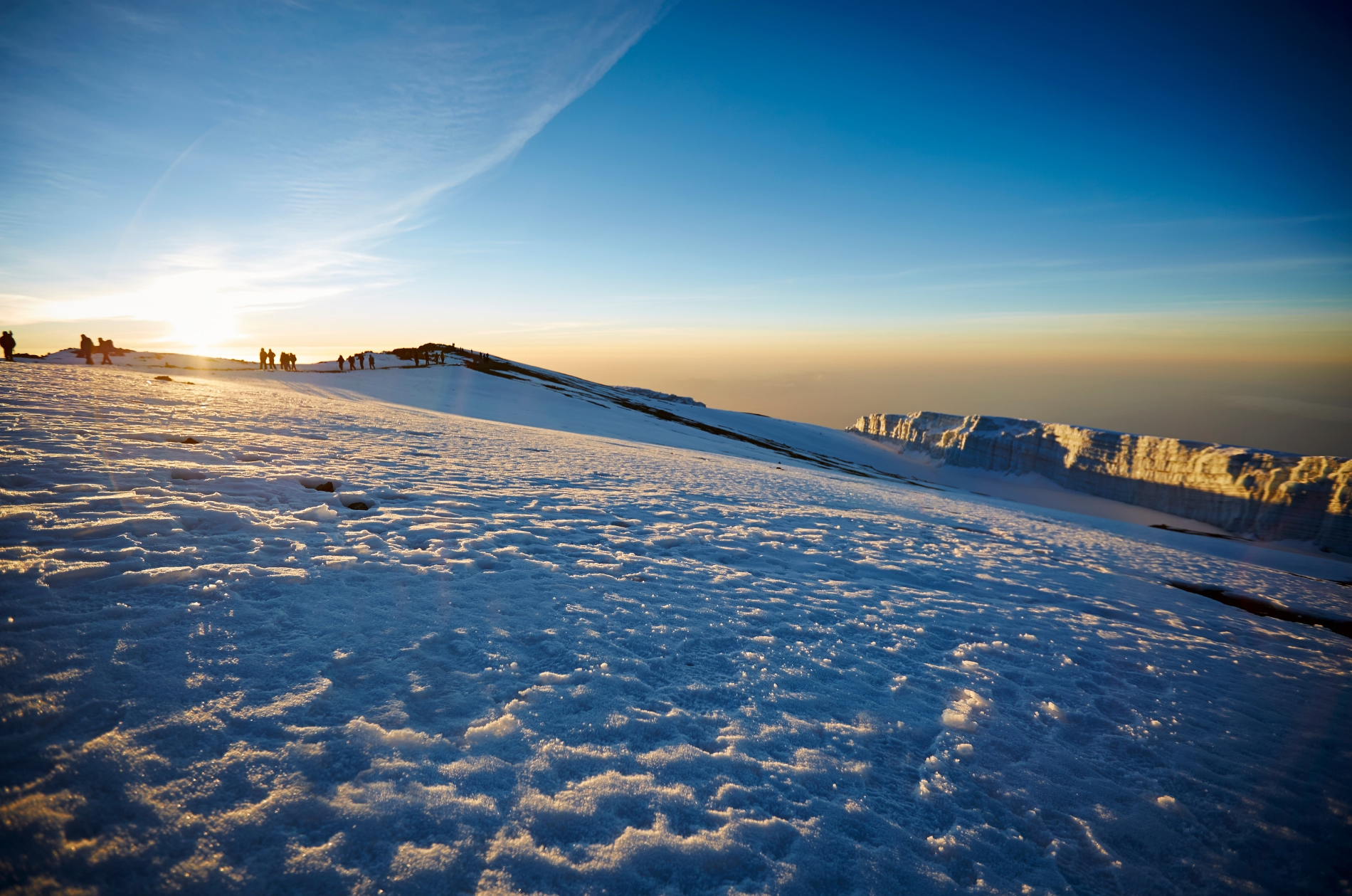
Eventually, you reach Uhuru Peak at 5,895 metres or 19,341 feet, the highest point on Mount Kilimanjaro and the entire African continent.
Standing at Uhuru Peak is an emotional and unforgettable moment. After days of preparation, changing landscapes, cold nights, steep trails, and high altitude challenges, you have reached the Roof of Africa.
Time at the summit is normally limited because of cold temperatures, altitude, changing weather, and the need to descend. You will have an opportunity to take photographs near the summit sign, appreciate the surrounding glaciers, and celebrate with your guide and fellow climbers.
You then begin descending toward Stella Point and Barafu Camp. The descent over loose scree can be tiring on the knees, and trekking poles are highly useful. Upon reaching Barafu Camp, you will rest briefly, eat, and collect the remaining equipment.
The journey continues downward toward Mweka Camp, covering approximately 12 kilometres from Uhuru Peak. As you lose altitude, breathing gradually becomes easier and temperatures become warmer.
Mweka Camp lies at approximately 3,068 metres in the upper forest zone. After one of the longest days of the expedition, you will have dinner, share stories with the team, and enjoy a well deserved night of rest.
Additional Experiences During Summit Day
- Sunrise viewing from Stella Point or the crater rim
- Summit photographs at Uhuru Peak
- Glacier and ice field photography
- Views toward Mawenzi Peak
- Celebration with your mountain guide and team
- Observation of the volcanic crater rim
- Rest and refreshments at Barafu Camp
- Scenic descent into the upper forest
- Evening summit celebration at Mweka Camp
Accommodation: Mweka Camp
Meal plan: Breakfast, lunch, and dinner
Day 9: Mweka Camp to Mweka Gate and Return to Arusha
Starting point: Mweka Camp
Destination: Mweka Gate and Arusha
Approximate trekking distance: 10 kilometres
Approximate trekking time: 3 to 4 hours
Starting elevation: Approximately 3,068 metres or 10,065 feet
Final elevation at Mweka Gate: Approximately 1,640 metres or 5,380 feet
Approximate drive to Arusha: 2 to 3 hours
Vegetation zone: Montane rainforest
Main activities: Rainforest descent, certificate collection, crew farewell, hotel transfer, and celebration
After breakfast at Mweka Camp, you begin the final walking stage of your Kilimanjaro expedition. The trail descends approximately 10 kilometres through the beautiful montane rainforest toward Mweka Gate.
The descent normally takes between three and four hours. The trail may be wet, muddy, and slippery, especially during or after rainfall. Trekking poles remain useful, and careful footing is required.
As you move lower, the air becomes warmer and richer in oxygen. Dense vegetation returns, replacing the exposed alpine landscape of the previous days. Giant ferns, tall trees, mosses, flowers, and forest sounds create a refreshing final chapter to your mountain journey.
You may hear or occasionally see monkeys and forest birds. After many days in open and rocky environments, returning to the rainforest can feel like entering a completely different world.
Eventually, you arrive at Mweka Gate, situated at approximately 1,640 metres above sea level. Your guide completes the required exit procedures with Kilimanjaro National Park.
Eligible climbers who reached Stella Point or Uhuru Peak will normally receive an official summit certificate. This certificate represents not only the altitude reached, but also the determination, preparation, patience, and teamwork required throughout the expedition.
A farewell and tipping ceremony may be organised with the mountain crew. Tipping is customary on Mount Kilimanjaro and is normally presented as a group after the climb. Your guide can explain the recommended process during the pre climb briefing.
After saying goodbye to the mountain crew, you meet your transfer driver and begin the journey back to Arusha. Upon arrival at your hotel, you can enjoy a warm shower, change into clean clothing, rest, and celebrate your achievement.
The evening is at leisure. You may enjoy dinner at the hotel or visit a restaurant in Arusha. This is also an excellent time to organise photographs, contact family and friends, and reflect on your journey from the rainforest to the summit of Africa.
Additional Activities After the Climb
- Summit celebration dinner
- Relaxing massage at the hotel or a local wellness facility
- Souvenir shopping in Arusha
- Cultural Heritage Centre visit
- Arusha city tour
- Coffee estate visit
- Preparation for a Tanzania wildlife safari
- Preparation for a Zanzibar beach extension
- Rest and recovery at the hotel
Accommodation: Hotel in Arusha
Meal plan: Breakfast
Day 10: Departure from Arusha
Location: Arusha
Destination: Kilimanjaro International Airport or your next Tanzania destination
Approximate airport distance: 50 to 55 kilometres
Approximate transfer time: 1 to 1.5 hours
Main activities: Breakfast, hotel check out, airport transfer, or continuation of your Tanzania holiday
Today marks the conclusion of your 10 Days Lemosho Route with 8 Days Hiking. After breakfast at the hotel, you will have time to rest or complete any final preparations before checking out.
Depending on your international flight schedule, a representative from Woodland Trek & Safaris will collect you from the hotel and transfer you to Kilimanjaro International Airport. The drive normally takes approximately one to one and a half hours, depending on traffic and road conditions.
You will arrive at the airport with sufficient time to complete airline check in, luggage procedures, immigration formalities, and security screening.
Although your Kilimanjaro climb has ended, Tanzania offers many opportunities to continue your journey. You may combine the mountain expedition with a wildlife safari through Tarangire National Park, Lake Manyara National Park, Serengeti National Park, and Ngorongoro Crater. You may also travel to Zanzibar for a relaxing beach holiday beside the Indian Ocean.
As you leave Tanzania, you carry more than photographs and a summit certificate. You carry the memory of walking through ancient rainforest, crossing the Shira Plateau, climbing above the clouds, facing the cold darkness of summit night, and standing on the highest point in Africa.
Woodland Trek & Safaris thanks you for choosing us to organise your Kilimanjaro adventure and wishes you a safe journey home.
Optional Extensions After Kilimanjaro
- Tanzania wildlife safari
- Serengeti and Ngorongoro safari
- Tarangire and Lake Manyara safari
- Zanzibar beach holiday
- Arusha National Park day trip
- Materuni Waterfalls and coffee tour
- Lake Chala day trip
- Cultural tourism experience
- Mount Meru area exploration
Accommodation: Not included unless an extension is booked
Meal plan: Breakfast
Major Highlights of the 10 Days Lemosho Route
- Begin the adventure from Arusha, Tanzania’s northern tourism centre
- Trek through the remote western side of Mount Kilimanjaro
- Walk beneath the canopy of Kilimanjaro’s montane rainforest
- Cross the spectacular Shira Plateau
- Experience multiple ecological and climatic zones
- Reach Lava Tower at approximately 4,630 metres
- Sleep beneath the dramatic Barranco Wall
- Complete the exciting Barranco Wall ascent
- Walk through Karanga Valley and the alpine desert
- Prepare for the summit at Barafu Camp
- Watch the sunrise from the upper slopes of Kilimanjaro
- Reach Uhuru Peak at 5,895 metres
- Stand on the highest point in Africa
- View glaciers, volcanic formations, and the crater rim
- Descend through the Mweka rainforest
- Receive a Kilimanjaro summit certificate when eligible
- Celebrate with the professional mountain crew
- Enjoy a gradual eight day climbing schedule
At Woodland Trek & Safaris, every journey is carefully designed around you. We go beyond fixed itineraries to create flexible, tailor-made Tanzania safari experiences shaped by your interests, preferred travel pace, budget, and personal travel style. From the moment you contact us, our experienced local travel specialists work closely with you to plan a personalised adventure that captures the true beauty, wildlife, culture, and spirit of Tanzania. This is more than an ordinary holiday. It is your journey, your story, and your opportunity to experience Tanzania in a meaningful and unforgettable way. With thoughtful planning, professional guidance, and genuine local hospitality, Woodland Trek & Safaris is committed to creating a travel experience that exceeds your expectations.
Practical Info
How to Book Your Safari
Preparing for a Safari
Preparing for Mountain Climbing
Visa in Tanzania
Conservation In Tanzania
Weather In Tanzania
Read Reviews

Follow us
- Woodland Trek Safaris Ltd
- @woodlandtrek_safari
- +255 682 956 506
- +255 769 950 057
- info@woodlandtrekandsafaris.com
- sales@woodlandtrekandsafaris.com
- Arusha, Tanzania
We Accept