

Tour Type
Mountain Climbing
Tour Duration
9 Days 8 Nights
Min. No of Pax
1
Tour Price
Budget
On request
Mid-range
On request
Luxury
On request
The Price Includes
- Airport pickup from Kilimanjaro International Airport
- Departure airport transfer
- Two nights hotel accommodation in Arusha
- Bed and breakfast accommodation in Arusha
- Transportation from Arusha to the Rongai starting area
- Transportation from Marangu Gate back to Arusha
- Kilimanjaro National Park entrance fees
- Kilimanjaro conservation fees
- Kilimanjaro camping and applicable hut fees
- Kilimanjaro rescue fees
- Government taxes applicable to the confirmed climbing package
- Professional licensed Kilimanjaro mountain guide
- Assistant guides according to group size
- Professional mountain cook
- Porters for group equipment and permitted personal luggage
- Mountain crew salaries
- Mountain tents during the Rongai ascent
- Camping equipment
- Dining tent where applicable
- Tables and chairs where applicable
- Cooking equipment
- Group mountain equipment
- Three meals per day while on the mountain
- Safe drinking water during the climb
- Pre climb briefing in Arusha
- Personal trekking equipment inspection
- National park registration assistance
- Regular general health and altitude monitoring
- Basic mountain first aid equipment
- Summit preparation briefing
- Official summit certificate for eligible climbers
- Services specifically mentioned in the confirmed itinerary
The Price Excludes
- International flights
- Domestic flights unless specifically included
- Tanzania entry visa
- Passport expenses
- Travel insurance
- High altitude trekking insurance
- Emergency evacuation insurance beyond standard park rescue arrangements
- Personal trekking clothing
- Hiking boots
- Sleeping bag unless specifically included
- Trekking poles unless specifically included
- Personal daypack
- Personal duffel bag unless provided
- Personal medication
- Vaccinations
- Medical consultations
- Alcoholic beverages
- Bottled soft drinks
- Laundry services
- Telephone calls
- Internet expenses
- Souvenirs
- Personal shopping
- Optional tours in Arusha
- Tanzania safari extensions
- Zanzibar extensions
- Additional hotel nights not stated in the itinerary
- Meals in Arusha except those specifically included
- Tips for guides, assistant guides, cooks, and porters
- Expenses resulting from illness
- Costs caused by early mountain descent
- Expenses caused by flight cancellations or delays
- Personal equipment rental unless specifically included
- Services not clearly mentioned under Price Includes
Tour Overview
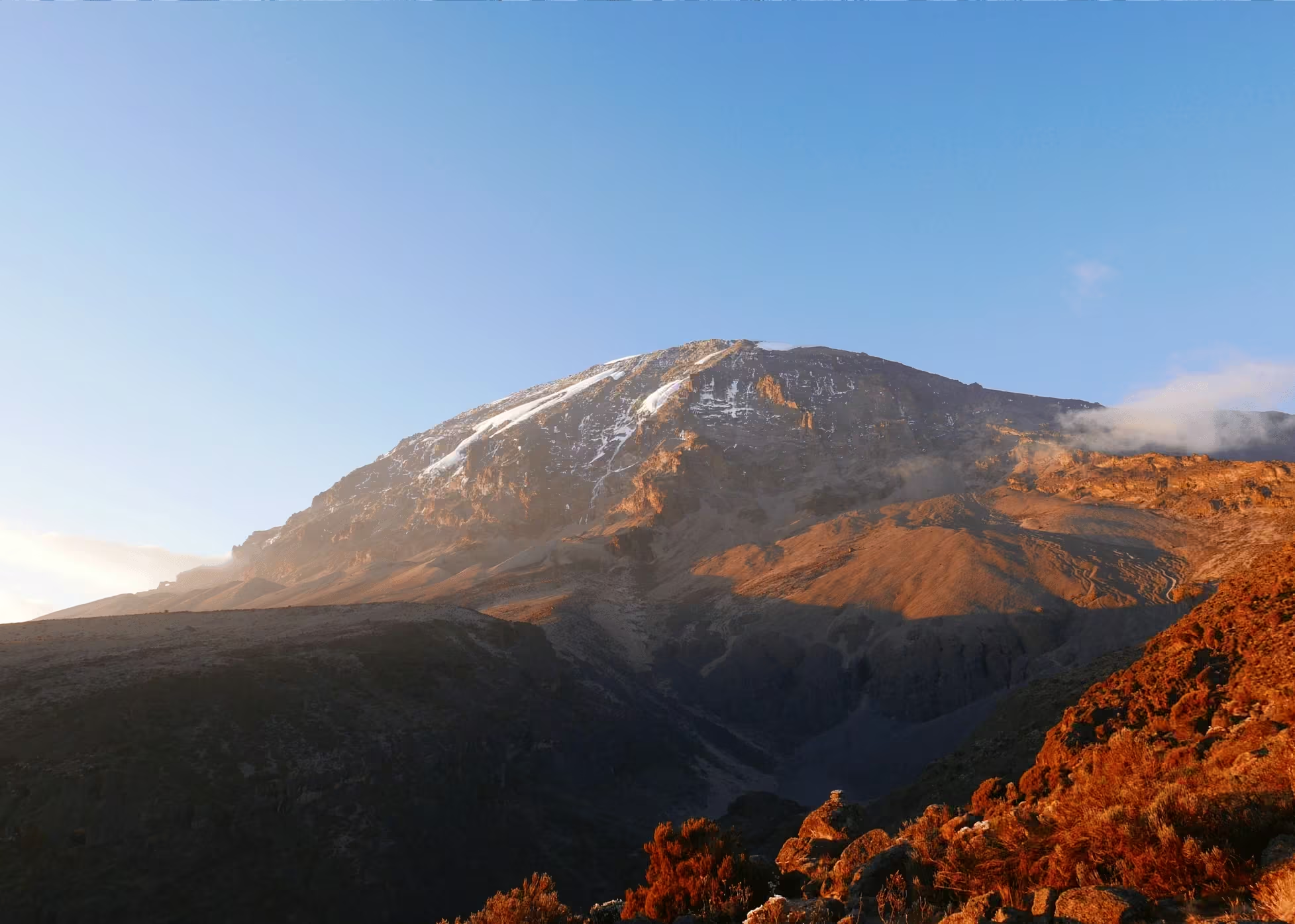
The 9 Days Rongai Route with 7 Days Hiking is a scenic, quieter, and highly rewarding Mount Kilimanjaro climbing itinerary that approaches Africa’s highest mountain from the northern side near the Tanzania and Kenya border. It is an excellent choice for travelers looking for a less crowded Kilimanjaro trekking experience, a gradual ascent profile, varied scenery, excellent views of Mawenzi and Kibo, and a route that offers a completely different perspective from the more frequently used southern trails.
Organized by Woodland Trek & Safaris, a professional tour company based in Arusha, Tanzania, this itinerary combines one arrival day, seven days of mountain trekking, and one departure day. The route has been designed to provide a balanced progression through Kilimanjaro’s ecological zones while allowing valuable time for acclimatization before the final summit attempt.
The Rongai Route is one of the most distinctive ways to climb Mount Kilimanjaro because it is the only major route that begins on the northern side of the mountain. Most Kilimanjaro routes approach from the south or west, but Rongai starts close to the Kenyan border and passes through remote forest, open moorland, alpine terrain, Mawenzi landscapes, the Kibo saddle, and eventually the arctic summit zone.
One of the greatest attractions of the Rongai Route is its peaceful character. The northern side of Mount Kilimanjaro generally receives fewer climbers than routes such as Machame and Marangu, especially during the early stages of the trek. This gives travelers more time to enjoy the mountain landscape, forest trails, open wilderness, wildlife possibilities, and uninterrupted views without feeling surrounded by large groups.
The route also has a reputation for being relatively dry compared with the southern slopes. The northern side lies in a different rainfall pattern and often receives less precipitation. This can make Rongai particularly attractive during wetter months, although weather on Kilimanjaro is always unpredictable and waterproof clothing remains essential.
The expedition begins in Arusha, where you will meet the Woodland Trek & Safaris mountain team, complete your pre climb briefing, inspect your trekking equipment, and prepare for the days ahead.
The following morning, you travel from Arusha toward the northeastern side of Kilimanjaro. The drive normally passes through Moshi and continues toward the Rongai area near the Kenya border. After completing registration procedures at the relevant Kilimanjaro National Park entry point, you continue toward the trailhead and begin your first mountain hike.
The lower Rongai trail passes through cultivated land and forest before entering increasingly remote terrain. Compared with some southern approaches, the forest can feel more open and peaceful, and wildlife sightings may occasionally include monkeys, birds, antelope, and other animals inhabiting the lower mountain slopes.
As you climb higher, the forest gives way to heath and moorland. The landscape opens dramatically, and views of Kibo, the highest volcanic cone of Mount Kilimanjaro, become increasingly impressive.
The route gradually progresses toward Second Cave and Kikelewa, where climbers gain elevation while experiencing broad views across the northern plains of Tanzania and, on clear days, toward Kenya.
A major highlight of the Rongai Route is the approach to Mawenzi Tarn, a spectacular campsite located beneath the rugged cliffs of Mawenzi. Mawenzi is one of Kilimanjaro’s three principal volcanic cones and is dramatically different from the broad dome of Kibo.
Its jagged peaks, steep ridges, dark volcanic rock, and alpine scenery create some of the most memorable landscapes of the climb.
The itinerary includes valuable acclimatization opportunities around Mawenzi Tarn. Spending time at this elevation before continuing toward Kibo allows the body additional opportunity to adapt to the reduced oxygen levels.
After Mawenzi Tarn, the route crosses the extraordinary Saddle between Mawenzi and Kibo.
This section is one of the most dramatic high altitude landscapes on Mount Kilimanjaro.
The Saddle is broad, dry, exposed, and almost lunar in appearance. Vegetation becomes extremely limited, and the contrast between Mawenzi behind you and Kibo ahead creates a powerful sense of scale.
Eventually, you reach Kibo Hut, the final high altitude base before the summit attempt.
Kibo Hut stands at approximately 4,703 metres above sea level in the alpine desert zone.
Here, climbers eat, prepare their summit clothing, organise headlamps and trekking poles, and rest before beginning the final ascent around midnight.
The summit night is the most physically and mentally demanding stage of the entire Rongai Route expedition.
You leave Kibo in darkness and climb over steep volcanic scree toward Gilman’s Point, located on the crater rim at approximately 5,685 metres.
The combination of cold temperatures, darkness, steep terrain, fatigue, and thin air requires patience and determination.
Upon reaching Gilman’s Point, climbers who are fit and safe enough to continue proceed along the crater rim toward Uhuru Peak at 5,895 metres or 19,341 feet.
Uhuru Peak is the highest point on Mount Kilimanjaro, the highest point in Tanzania, and the highest point on the African continent.
The final approach may provide extraordinary views of glaciers, volcanic formations, the crater rim, and the first light of sunrise spreading across the landscape below.
Standing at Uhuru Peak is one of the great achievements of African adventure travel.
However, the summit is only one part of the experience.
The Rongai Route is equally memorable for its quiet northern forests, remote wilderness, open moorland, Mawenzi scenery, alpine desert, changing temperatures, campsite atmosphere, and interaction with the professional mountain crew.
After reaching the summit, the descent follows a different route.
You return to Kibo Hut briefly and then descend south toward Horombo Hut.
This creates an interesting traverse of the mountain because you begin on the northern side and finish on the southeastern side.
The final descent continues from Horombo through Mandara and the montane rainforest to Marangu Gate.
This means that the Rongai Route provides both a northern ascent and a southeastern descent, allowing trekkers to experience multiple sides of Kilimanjaro within a single expedition.
For many travelers, this is one of the route’s greatest advantages.
The landscape changes continuously, and you are not simply retracing the same trail you climbed.
The 7 Day Rongai Route is especially suitable for climbers who prefer a more gradual itinerary than the shorter versions.
Altitude remains the greatest challenge on Mount Kilimanjaro, regardless of the route chosen.
Spending more time on the mountain allows additional opportunities for acclimatization, hydration, rest, and gradual adaptation.
No itinerary can guarantee successful acclimatization or summit success, but a slower schedule is generally preferable to rushing upward.
Mount Kilimanjaro rises to 5,895 metres above sea level and is one of the world’s most famous high altitude trekking mountains.
It is composed of three major volcanic formations known as Shira, Mawenzi, and Kibo.
Shira is the oldest and most heavily eroded cone.
Mawenzi forms the dramatic jagged eastern peak visible during the Rongai ascent.
Kibo is the highest and broadest cone and contains the summit known as Uhuru Peak.
The Rongai Route gives climbers especially impressive views of Mawenzi because the trail approaches from the northeast.
The mountain’s ecological diversity is another major highlight.
During only a few days, you travel from cultivated land and forest into heath, moorland, alpine desert, and eventually the arctic summit zone.
The lower forest supports birds, monkeys, and other mountain wildlife.
The moorland is dominated by grasses, shrubs, heathers, and high altitude plants.
The alpine desert is dry, rocky, windy, and exposed.
The summit zone is characterised by freezing temperatures, volcanic terrain, glaciers, snow, and extremely sparse vegetation.
This progression creates an experience that feels like a journey through several different climates within one mountain.
The Rongai Route is often described as moderate compared with some other Kilimanjaro routes because of its relatively gradual early slopes.
However, it should never be considered easy.
Kilimanjaro remains a serious high altitude expedition.
Climbers must cope with long trekking days, steep summit terrain, reduced oxygen, cold temperatures, variable weather, limited comfort, and physical fatigue.
Good physical preparation is strongly recommended.
Before traveling to Tanzania, climbers should practise long walks, hill hiking, cardiovascular exercise, stair climbing, leg strengthening, and carrying a daypack.
Mental preparation is equally important.
Your guides will frequently encourage you to walk pole pole, which means slowly, slowly in Swahili.
This philosophy is central to successful Kilimanjaro trekking.
Climbing too quickly can waste energy and may make altitude adaptation more difficult.
A steady, controlled walking pace allows you to conserve strength for the higher mountain stages.
Throughout the expedition, you will be supported by an experienced mountain team from Woodland Trek & Safaris.
Depending on group size, the crew may include a lead guide, assistant guides, cooks, and porters.
The team manages group equipment, prepares meals, helps establish camps, assists with logistics, monitors climbers, and provides encouragement throughout the journey.
The relationship between climbers and mountain crew often becomes one of the most memorable parts of the Kilimanjaro experience.
Together, you share early mornings, long trekking days, cold evenings, stories, songs, meals, and the collective excitement of moving closer to the summit.
The Rongai Route is therefore ideal for travelers who want something quieter, more remote, and different from the busiest Kilimanjaro trails.
It is suitable for solo travelers, private groups, couples, friends, families with appropriate fitness, charity groups, and adventurous travelers seeking a scenic Kilimanjaro summit experience.
Whether you are climbing Africa’s highest mountain as a personal challenge, fulfilling a lifelong dream, celebrating an important milestone, or simply looking for one of Tanzania’s greatest adventure experiences, this itinerary provides a memorable journey from the northern wilderness to the Roof of Africa.
With Woodland Trek & Safaris, based in Arusha, Tanzania, you can experience the Rongai Route with a locally organized mountain team that understands the landscapes, culture, conditions, and rhythm of Kilimanjaro.
Essential Tour Information
- Total itinerary duration: 9 days and 8 nights
- Actual mountain hiking duration: 7 days and 6 nights
- Starting city: Arusha, Tanzania
- Mountain starting side: Northern and northeastern Mount Kilimanjaro
- Primary starting trail: Rongai Route
- Mountain finishing point: Marangu Gate
- Highest point: Uhuru Peak at 5,895 metres or 19,341 feet
- Highest sleeping point: Kibo Hut at approximately 4,703 metres
- Approximate trekking distance: Around 75 to 80 kilometres depending on acclimatization walks and campsite routes
- Difficulty: Challenging high altitude trek
- Technical climbing required: No conventional technical climbing normally required
- Accommodation on the mountain: Tented camping during the Rongai ascent and hut facilities around Kibo where applicable
- Accommodation before and after the climb: Hotel in Arusha
- Recommended fitness: Good general fitness with hiking preparation
- Main vegetation zones: Forest, heath, moorland, alpine desert, and arctic summit zone
- Major mountain landmarks: Second Cave, Kikelewa, Mawenzi Tarn, Mawenzi Peak, Kibo Saddle, Kibo Hut, Gilman’s Point, and Uhuru Peak
- Main summit approach: Kibo Hut through Gilman’s Point
- Main descent: Kibo to Horombo, Mandara, and Marangu Gate
- Best suited for: Climbers seeking a quieter Kilimanjaro route with beautiful northern scenery and strong views of Mawenzi
Why Choose the 7 Day Rongai Route
Quieter Northern Approach
One of the strongest reasons to choose the Rongai Route is the reduced number of climbers during the early sections.
The northern trail is generally less busy than routes such as Machame and Marangu.
This allows you to experience a more peaceful mountain atmosphere and enjoy the landscape with fewer trekking groups around you.
Unique Northern Kilimanjaro Scenery
Rongai provides views that are different from the southern routes.
You approach Kibo from the northeast and enjoy exceptional views of Mawenzi, the northern plains, and the broad volcanic landscape between the two principal cones.
Excellent Mawenzi Experience
The approach to Mawenzi Tarn is one of the great highlights of the route.
The campsite beneath Mawenzi’s rugged cliffs creates a dramatic high altitude setting and provides an excellent location for acclimatization.
Gradual Early Ascent
The early Rongai trail rises at a relatively steady pace compared with some steeper Kilimanjaro routes.
This can make the first several days feel more manageable while still allowing gradual altitude gain.
Drier Northern Side
The northern side of Kilimanjaro often receives less rainfall than the southern slopes.
This does not mean rain cannot occur, but the route may be appealing during wetter periods.
Different Ascent and Descent Trails
The Rongai Route climbs the northern side but descends through the Marangu Route.
This creates a genuine mountain traverse and allows you to experience different landscapes instead of returning along the same path.
Seven Day Acclimatization Schedule
The seven day mountain programme provides more time for gradual altitude adaptation than shorter Rongai itineraries.
The itinerary includes valuable altitude exposure around Mawenzi before continuing toward Kibo.
Day To day
DAY 1 ARRIVAL AT KILIMANJARO INTERNATIONAL AIRPORT AND TRANSFER TO ARUSHA
Location: Kilimanjaro International Airport and Arusha
Approximate driving distance: 50 to 55 kilometres
Approximate driving time: 1 to 1.5 hours
Elevation in Arusha: Approximately 1,400 metres or 4,593 feet
Major activities: Airport reception, hotel transfer, mountain briefing, equipment inspection, and expedition preparation
Welcome to Tanzania and the beginning of your 9 Days Rongai Route Kilimanjaro climbing adventure.
After arriving at Kilimanjaro International Airport, you will complete immigration, baggage collection, and airport procedures before meeting a representative from Woodland Trek & Safaris.
You then travel toward Arusha, one of northern Tanzania’s most important tourism and adventure centres.
The transfer normally takes approximately one to one and a half hours, depending on traffic and the location of your hotel.
Along the way, you may see open countryside, local settlements, agricultural land, coffee plantations, and the foothills surrounding Arusha.
When visibility is good, Mount Meru may rise dramatically above the city, while Mount Kilimanjaro may occasionally be visible in the distance.
After arriving at your hotel, you will have time to rest and recover from your flight.
Later, you meet your professional Kilimanjaro guide for a detailed pre climb briefing.
Your guide will explain the Rongai Route, hiking times, expected elevations, campsite routines, acclimatization, mountain weather, meals, luggage regulations, safety procedures, and summit strategy.
Your personal trekking equipment will also be inspected.
Important items normally include properly fitted hiking boots, waterproof clothing, warm layers, thermal base layers, insulated gloves, sleeping bag, trekking poles, headlamp, sunglasses, sun protection, hydration system, and personal medication.
If any important items are missing, your team may assist with available rental or purchasing options in Arusha.
The remainder of the evening should be used for packing, hydration, and rest.
You should separate the equipment carried by porters from the items you need inside your daypack.
Unnecessary luggage can normally remain safely stored at the hotel.
A good night’s sleep is recommended because tomorrow you travel toward the remote northern side of Mount Kilimanjaro.
Extra Activities in Arusha
- Explore Arusha city centre
- Visit local craft markets
- Visit the Cultural Heritage Centre
- Enjoy an optional coffee tour
- Purchase or rent missing trekking equipment
- Relax at your hotel
- Meet your climbing companions
- Review your trekking gear with your guide
- Exchange money for personal expenses and mountain tips
Accommodation: Hotel in Arusha
Meals: Bed and breakfast
DAY 2 ARUSHA TO RONGAI GATE AND TREK TO SIMBA CAMP
Starting location: Arusha
Mountain entrance: Rongai side of Mount Kilimanjaro
Destination: Simba Camp
Approximate driving distance: 190 to 210 kilometres
Approximate driving time: 4 to 5 hours
Approximate trekking distance: 7 kilometres
Approximate hiking time: 3 to 4 hours
Starting elevation: Approximately 1,950 metres or 6,398 feet
Sleeping elevation at Simba Camp: Approximately 2,625 metres or 8,612 feet
Approximate elevation gain: 675 metres
Vegetation zones: Cultivated land, forest, and lower heath
Major activities: Road transfer, national park registration, forest trekking, wildlife observation, and camping
After an early breakfast at your hotel, you leave Arusha and begin the long but scenic transfer toward the northern side of Mount Kilimanjaro.
The journey generally passes through the Kilimanjaro region before continuing toward the Rongai area near the Kenya border.
The drive covers approximately 190 to 210 kilometres and may take around four to five hours, depending on road conditions, traffic, registration procedures, and the exact trailhead used.
The journey itself offers an excellent introduction to northern Tanzania.
You pass through towns, villages, agricultural areas, open countryside, and landscapes beneath Kilimanjaro.
As you approach Rongai, the environment becomes increasingly rural and peaceful.
Upon arrival at the national park registration point, your guide completes the necessary Kilimanjaro National Park entry procedures while the mountain crew organises equipment, food, tents, porter loads, and group supplies.
Once registration is complete, you continue toward the trailhead and begin the first hike of your Rongai Route expedition.
Today’s trek covers approximately 7 kilometres and normally takes between three and four hours.
The route initially passes through cultivated land before entering forest.
The northern forest can feel quieter and more open than some sections on the southern side of Kilimanjaro.
You may hear birds, see signs of wildlife, and occasionally encounter monkeys or antelope.
Wildlife sightings are never guaranteed, but the remote northern approach provides a strong feeling of wilderness.
As you climb gradually, your guide will establish the slow and steady pace that will become normal throughout the expedition.
The first day is relatively manageable, but it is important not to walk too quickly.
You are already gaining altitude, and conserving energy from the beginning will help during the higher stages.
Eventually, you arrive at Simba Camp, positioned at approximately 2,625 metres above sea level.
Simba means lion in Swahili, although the camp name does not mean that lions are commonly encountered there.
The site sits near the transition between forest and heath and provides a peaceful first night on the mountain.
Your tents will normally be prepared by the mountain crew.
After changing into dry and warm clothing, you can enjoy refreshments and rest before dinner.
Your guide will provide a short briefing about the following day’s hike and may ask about your appetite, hydration, energy level, headache symptoms, and general condition.
Extra Activities at Simba Camp
- Forest and landscape photography
- Birdwatching
- Short supervised acclimatization walk
- Wildlife observation around the trail
- Introduction to northern Kilimanjaro vegetation
- Guided stretching
- Mountain crew introduction
- Sunset observation
- Evening altitude briefing
Accommodation: Simba Camp
Meals: Breakfast, lunch, and dinner
DAY 3 SIMBA CAMP TO SECOND CAVE AND KIKELEWA CAMP
Starting point: Simba Camp
Intermediate landmark: Second Cave
Destination: Kikelewa Camp
Approximate trekking distance: 11 to 12 kilometres
Approximate hiking time: 6 to 8 hours
Starting elevation: Approximately 2,625 metres
Second Cave elevation: Approximately 3,450 metres
Sleeping elevation at Kikelewa Camp: Approximately 3,600 metres or 11,811 feet
Approximate elevation gain: 975 metres
Vegetation zone: Heath and moorland
Major activities: Moorland trekking, Kibo viewing, acclimatization, northern landscape photography, and wilderness trekking
After breakfast at Simba Camp, you begin a longer trekking day across Kilimanjaro’s northern slopes.
The trail gradually leaves the remaining forest behind and enters the open heath and moorland zone.
Today’s route is approximately 11 to 12 kilometres and may require around six to eight hours of walking.
The actual hiking time depends on weather, group pace, altitude response, and rest stops.
The first major objective is Second Cave, located at approximately 3,450 metres above sea level.
The route climbs steadily across open terrain, providing increasingly impressive views toward Kibo.
As the vegetation becomes lower and more widely spaced, the enormous scale of Kilimanjaro becomes more obvious.
On clear days, Kibo may dominate the skyline ahead.
Looking back, you may enjoy views across the plains of northern Tanzania and, depending on atmospheric conditions, toward Kenya.
The northern landscape feels open, quiet, and expansive.
The trail around Second Cave provides an excellent place to rest, eat, and allow your body time to adjust to the increased elevation.
After leaving Second Cave, you continue southeast toward Kikelewa Camp.
The trail crosses gently undulating terrain with changing views of Kibo and Mawenzi.
Mawenzi begins to appear increasingly dramatic, with its jagged summit ridges contrasting sharply with the broad volcanic shape of Kibo.
The hike becomes more physically demanding as the elevation increases.
You should continue drinking regularly and follow your guide’s slow pace.
Eventually, you arrive at Kikelewa Camp at approximately 3,600 metres above sea level.
The camp lies in a relatively sheltered valley and provides dramatic views toward Mawenzi.
By this stage, the air is noticeably thinner than at Simba Camp.
Some climbers may experience mild headache, reduced appetite, disturbed sleep, or shortness of breath.
These symptoms should always be discussed openly with your guide.
After arriving at camp, you will have time to rest, eat, hydrate, and enjoy the surroundings.
An optional short acclimatization walk may be arranged if weather and group condition allow.
Extra Activities at Kikelewa Camp
- Photography of Kibo
- Mawenzi landscape photography
- Short acclimatization hike
- Moorland vegetation observation
- Panoramic views toward Kenya
- Sunset viewing
- High altitude breathing exercises
- Guided stretching
- Altitude health assessment
Accommodation: Kikelewa Camp
Meals: Breakfast, lunch, and dinner
DAY 4 KIKELEWA CAMP TO MAWENZI TARN CAMP
Starting point: Kikelewa Camp
Destination: Mawenzi Tarn Camp
Approximate trekking distance: 5 kilometres
Approximate hiking time: 4 to 5 hours
Starting elevation: Approximately 3,600 metres
Sleeping elevation at Mawenzi Tarn: Approximately 4,330 metres or 14,206 feet
Approximate elevation gain: 730 metres
Vegetation zones: Moorland and alpine desert transition
Major activities: Steep ascent, Mawenzi exploration, high altitude trekking, photography, and acclimatization
Today’s hike is shorter in distance but involves a significant gain in elevation.
After breakfast, you leave Kikelewa Camp and climb toward Mawenzi Tarn, one of the most beautiful and dramatic campsites on Mount Kilimanjaro.
The trail covers approximately 5 kilometres and normally takes between four and five hours.
The route climbs more steeply than the previous day’s trail, and the effects of altitude become increasingly noticeable.
The vegetation gradually becomes sparse as you approach the alpine desert zone.
The landscape is dominated by volcanic rock, open ridges, and the imposing cliffs of Mawenzi.
As you climb, Mawenzi appears increasingly close.
Unlike the smoother and broader shape of Kibo, Mawenzi is rugged, sharp, and heavily eroded.
Its dark volcanic ridges create one of the most striking landscapes on Kilimanjaro.
Eventually, you reach Mawenzi Tarn Camp at approximately 4,330 metres above sea level.
The camp sits in a dramatic basin beneath Mawenzi.
A tarn is a small mountain lake or pool formed within a glacial or volcanic landscape.
The surrounding cliffs and high altitude environment create an exceptional setting for photography and acclimatization.
Today’s sleeping elevation is significantly higher than Kikelewa.
For this reason, the afternoon should be approached calmly.
After arriving, you will eat, hydrate, and rest.
If your guide considers it appropriate, you may complete a short additional acclimatization walk around the surrounding ridges before returning to camp.
Temperatures can become very cold after sunset.
Warm clothing should therefore remain easily accessible.
The evening offers a wonderful opportunity to observe the dramatic silhouette of Mawenzi as light changes across the rock.
Extra Activities at Mawenzi Tarn
- Mawenzi photography
- Short acclimatization walk
- Tarn landscape photography
- Geological interpretation
- High altitude breathing practice
- Ridge observation
- Sunset viewing
- Stargazing when skies are clear
- Altitude health monitoring
- Guided stretching
Accommodation: Mawenzi Tarn Camp
Meals: Breakfast, lunch, and dinner
DAY 5 MAWENZI TARN ACCLIMATIZATION DAY
Starting point: Mawenzi Tarn Camp
Destination: Mawenzi Tarn Camp
Approximate acclimatization trekking distance: 4 to 7 kilometres depending on selected route
Approximate hiking time: 3 to 5 hours
Starting elevation: Approximately 4,330 metres
Possible highest acclimatization point: Approximately 4,500 to 4,600 metres depending on guide assessment
Sleeping elevation: Approximately 4,330 metres
Vegetation zone: Alpine desert
Major activities: Acclimatization hiking, Mawenzi exploration, altitude adaptation, rest, hydration, and summit preparation
Today is dedicated to high altitude acclimatization around Mawenzi Tarn.
This additional day is one of the most valuable parts of the 7 Day Rongai Route.
Instead of continuing directly toward Kibo, you remain around Mawenzi and complete a controlled acclimatization hike.
After breakfast, your guide will assess the condition of the group before selecting the most appropriate route.
The exact hike depends on weather, trail conditions, altitude response, and group fitness.
You may climb toward one of the surrounding ridges, reaching approximately 4,500 to 4,600 metres before returning to Mawenzi Tarn.
The purpose is not speed or distance.
The objective is to expose the body to a higher elevation before descending to sleep at the lower camp.
This approach can help support the acclimatization process.
The terrain around Mawenzi is spectacular.
Dark volcanic ridges rise above the campsite while broad views extend toward Kibo and the surrounding high altitude wilderness.
The landscape is dry, cold, and exposed.
Vegetation is extremely limited, creating a stark environment that feels far removed from the forest where your climb began.
During the hike, your guide may discuss high altitude breathing, hydration, pacing, summit preparation, and symptoms of altitude sickness.
You should communicate openly about any discomfort.
After returning to camp, the remainder of the day is devoted to rest, food, hydration, and preparation.
You can inspect your boots, organise clothing, charge or protect batteries, check your headlamp, and review your summit equipment.
The extra night at Mawenzi also gives you time to appreciate one of Kilimanjaro’s most dramatic geological landscapes.
Extra Activities During the Acclimatization Day
- Guided high altitude acclimatization hike
- Mawenzi ridge photography
- Geological interpretation
- Summit equipment review
- Daypack preparation
- Hiking boot and blister care
- Breathing exercises
- Guided stretching
- Hydration planning
- Nutrition preparation
- Altitude health assessment
- Sunset and landscape photography
- Mental preparation for the Kibo crossing
Accommodation: Mawenzi Tarn Camp
Meals: Breakfast, lunch, and dinner
DAY 6 MAWENZI TARN CAMP TO KIBO HUT
Starting point: Mawenzi Tarn Camp
Destination: Kibo Hut
Major landscape: The Saddle between Mawenzi and Kibo
Approximate trekking distance: 8 to 10 kilometres
Approximate hiking time: 5 to 7 hours
Starting elevation: Approximately 4,330 metres
Sleeping elevation at Kibo Hut: Approximately 4,703 metres or 15,430 feet
Approximate elevation gain: 373 metres
Vegetation zone: Alpine desert
Major activities: Saddle crossing, alpine desert trekking, Kibo viewing, summit preparation, and rest
After breakfast at Mawenzi Tarn, you begin one of the most visually dramatic stages of the entire Rongai Route.
Today’s trail leads across the enormous Saddle between Mawenzi and Kibo.
The trekking distance is approximately 8 to 10 kilometres, and the hike normally takes between five and seven hours.
The landscape is broad, dry, exposed, and almost completely devoid of vegetation.
Behind you, Mawenzi rises with sharp volcanic ridges.
Ahead, the massive cone of Kibo dominates the horizon.
The Saddle creates a sense of isolation unlike almost anywhere else on the mountain.
The terrain is not extremely steep for much of the day, but the elevation makes walking demanding.
At more than 4,000 metres above sea level, the air contains significantly less oxygen.
Your guide will therefore maintain a slow pace.
Regular hydration and short rest breaks are important.
The trail gradually approaches the eastern base of Kibo.
As the hut becomes visible, the mountain above it can appear enormous.
Eventually, you reach Kibo Hut at approximately 4,703 metres above sea level.
Kibo Hut is the final sleeping point before your summit attempt.
Upon arrival, you will have lunch or an early meal and begin preparing your equipment.
Your guide will provide a comprehensive summit briefing.
This normally includes the planned departure time, expected temperatures, pace, clothing layers, water storage, food, trekking poles, headlamps, communication, and safety procedures.
Most summit attempts begin around midnight.
Your summit daypack should contain only essential items.
These may include drinking water, energy snacks, headlamp, spare batteries, warm gloves, waterproof layers, insulating clothing, sunglasses, sunscreen, and personal medication.
Your warm clothing should be arranged carefully so that layers can be adjusted efficiently.
You will normally eat an early dinner and rest for several hours.
Sleep may be difficult because of the altitude and anticipation, but remaining warm and relaxed helps conserve energy.
The next time you leave the hut, you will be walking toward the Roof of Africa.
Extra Activities at Kibo Hut
- Final summit briefing
- Summit clothing inspection
- Headlamp testing
- Battery check
- Trekking pole adjustment
- Hydration preparation
- Energy snack preparation
- Guided breathing exercises
- Short landscape photography session
- Final altitude health assessment
- Rest and mental preparation
Accommodation: Kibo Hut
Meals: Breakfast, lunch, and early dinner
DAY 7 KIBO HUT TO GILMAN’S POINT, UHURU PEAK AND DESCENT TO HOROMBO HUT
Starting point: Kibo Hut
First summit landmark: Gilman’s Point
Highest point: Uhuru Peak
Final destination: Horombo Hut
Approximate ascent distance: 6 kilometres
Approximate descent distance: 16 kilometres
Approximate total trekking distance: 20 to 22 kilometres
Approximate total hiking time: 12 to 16 hours
Starting elevation: Approximately 4,703 metres
Gilman’s Point elevation: Approximately 5,685 metres or 18,652 feet
Uhuru Peak elevation: 5,895 metres or 19,341 feet
Sleeping elevation at Horombo: Approximately 3,720 metres
Vegetation zones: Arctic summit zone, alpine desert, and moorland
Major activities: Midnight summit ascent, crater rim trekking, sunrise viewing, summit celebration, glacier viewing, and long descent
Today is the most demanding and memorable stage of your 7 Day Rongai Route Kilimanjaro expedition.
Your summit attempt begins around midnight after a light meal and final equipment check.
You leave Kibo Hut wearing your warmest clothing and headlamp.
The trail immediately begins climbing steeply over volcanic scree.
The darkness, freezing temperatures, high altitude, fatigue, and loose terrain make this section extremely challenging.
Your guides will maintain a very slow and controlled walking rhythm.
Pole pole becomes more important than ever.
At this altitude, energy must be conserved carefully.
You should focus on breathing, maintaining rhythm, and taking one step at a time.
A common intermediate landmark is Hans Meyer Cave, which provides a useful reference point during the ascent.
From there, the trail continues upward through a series of switchbacks toward the crater rim.
The hours before sunrise can feel long.
Temperatures may fall well below freezing.
Strong winds can make conditions feel even colder.
Water bottles should be insulated to reduce freezing, and warm gloves, thermal layers, and face protection are essential.
Eventually, you reach Gilman’s Point at approximately 5,685 metres above sea level.
This is a major summit point on Kilimanjaro.
Depending on your pace and departure time, sunrise may begin illuminating the mountain as you arrive.
Climbers who are fit enough and safely able to continue then proceed along the crater rim toward Uhuru Peak.
The final section is less steep than the climb to Gilman’s Point, but the extreme altitude makes progress slow.
Glaciers, snowfields, volcanic rock, and the crater rim create an extraordinary landscape.
Eventually, you reach Uhuru Peak at 5,895 metres or 19,341 feet above sea level.
You are now standing on the highest point of Mount Kilimanjaro, Tanzania, and the African continent.
For many travelers, this moment becomes one of the most powerful memories of their lives.
You may take summit photographs and enjoy a brief celebration with your guide.
However, time at the summit is limited because of the cold temperatures and extreme elevation.
You then begin descending back toward Gilman’s Point and Kibo Hut.
The descent through loose scree is faster than the ascent but can be demanding on the knees.
Trekking poles are extremely useful.
Upon reaching Kibo Hut, you will rest briefly, eat, and collect your belongings.
The journey then continues downhill toward Horombo Hut.
As you descend, the atmosphere becomes richer in oxygen and temperatures gradually become warmer.
After the long summit day, you arrive at Horombo Hut and enjoy a well deserved meal and night of rest.
Extra Experiences During Summit Day
- Sunrise from the crater rim
- Gilman’s Point photography
- Uhuru Peak photographs
- Glacier viewing
- Crater rim observation
- Views toward Mawenzi
- Summit celebration with your mountain guides
- High altitude landscape photography
- Scenic descent toward Horombo
- Evening summit celebration
Accommodation: Horombo Hut
Meals: Breakfast, lunch, and dinner
DAY 8 HOROMBO HUT TO MARANGU GATE AND RETURN TO ARUSHA
Starting point: Horombo Hut
Intermediate point: Mandara Hut
Mountain exit: Marangu Gate
Final destination: Arusha
Approximate trekking distance: 20 kilometres
Approximate hiking time: 6 to 8 hours
Starting elevation: Approximately 3,720 metres
Marangu Gate elevation: Approximately 1,860 metres
Approximate driving distance to Arusha: 120 to 130 kilometres
Approximate driving time: 2.5 to 3 hours
Vegetation zones: Moorland and montane rainforest
Major activities: Long descent, rainforest hiking, certificate collection, crew farewell, and hotel transfer
After breakfast at Horombo Hut, you begin the final mountain stage of your Rongai expedition.
Today’s descent covers approximately 20 kilometres and follows the Marangu Route toward Marangu Gate.
You first descend through the open moorland.
Mawenzi and Kibo gradually disappear behind you while temperatures become warmer and breathing becomes easier.
The trail continues toward Mandara Hut, where you may stop briefly for rest.
From Mandara, you enter the dense montane rainforest.
The change in scenery is dramatic.
Only a short time earlier, you were standing among rock, snow, ice, and freezing summit winds.
Now the trail is surrounded by tall trees, ferns, mosses, flowers, birds, and humid forest air.
Rain may make the lower trail slippery.
Careful footing remains important even though you are descending.
Eventually, you arrive at Marangu Gate, where your Kilimanjaro climb officially ends.
Your guide completes national park exit formalities.
Eligible climbers receive their official summit certificate according to the highest summit point reached.
You will also have the opportunity to thank and say goodbye to your mountain crew.
A tipping ceremony may be organised according to the procedures explained during your pre climb briefing.
After leaving Marangu Gate, you travel back to Arusha.
Upon arrival at your hotel, you can enjoy a hot shower, clean clothes, comfortable surroundings, and a well deserved rest.
The evening is yours to celebrate your achievement or simply relax.
Extra Activities After Kilimanjaro
- Celebration dinner in Arusha
- Massage and wellness treatment
- Souvenir shopping
- Cultural Heritage Centre visit
- Arusha city exploration
- Coffee tour
- Rest at the hotel
- Preparation for a Tanzania safari
- Preparation for a Zanzibar holiday
Accommodation: Hotel in Arusha
Meals: Breakfast
DAY 9 DEPARTURE FROM ARUSHA
Location: Arusha
Destination: Kilimanjaro International Airport or next Tanzania destination
Approximate driving distance: 50 to 55 kilometres
Approximate driving time: 1 to 1.5 hours
Elevation in Arusha: Approximately 1,400 metres
Major activities: Breakfast, hotel checkout, airport transfer, or continuation of your Tanzania holiday
Your 9 Days Rongai Route with 7 Days Hiking concludes today.
After breakfast, you may enjoy a relaxed morning depending on your international flight schedule.
A representative from Woodland Trek & Safaris will collect you from the hotel and transfer you to Kilimanjaro International Airport.
The journey normally takes approximately one to one and a half hours.
You should arrive with sufficient time to complete airline check in, baggage procedures, immigration, and security.
As you leave Tanzania, you carry the memories of one of Kilimanjaro’s most distinctive routes.
You began in the remote north.
You crossed quiet forest trails and open moorland.
You walked beneath the dramatic cliffs of Mawenzi.
You acclimatized among the volcanic ridges.
You crossed the vast Saddle toward Kibo.
Then, in the darkness of summit night, you climbed higher than anywhere else in Africa.
You reached Gilman’s Point.
You followed the crater rim.
And finally, you stood at Uhuru Peak at 5,895 metres above sea level.
But the summit is only part of the story.
You will remember the mountain crew, the cold evenings, the silence of the alpine desert, the changing light across Mawenzi, the slow rhythm of pole pole, and the feeling of watching sunrise from high above the African plains.
Your Tanzania journey can continue after Kilimanjaro.
Arusha provides easy access to some of Africa’s greatest wildlife destinations, including Tarangire National Park, Lake Manyara National Park, Ngorongoro Crater, and Serengeti National Park.
You may also travel to Zanzibar for a relaxing beach holiday beside the Indian Ocean.
Woodland Trek & Safaris is proud to have shared your Kilimanjaro experience and looks forward to welcoming you again in Tanzania.
Optional Tanzania Extensions
- Serengeti safari
- Ngorongoro Crater safari
- Tarangire safari
- Lake Manyara safari
- Arusha National Park day trip
- Materuni Waterfalls and coffee tour
- Chemka Hot Springs excursion
- Cultural tourism experience
- Zanzibar beach holiday
- Stone Town cultural tour
- Safari and Zanzibar combination
Accommodation: Not included unless an extension is booked
Meals: Breakfast
Main Highlights of the 9 Days Rongai Route
- Begin your adventure in Arusha, Tanzania
- Approach Kilimanjaro from the quieter northern side
- Trek through remote forest and heathland
- Experience fewer crowds during the early mountain stages
- Enjoy views toward Kenya and northern Tanzania
- Trek past Second Cave
- Stay at Kikelewa Camp
- Approach the dramatic Mawenzi volcanic cone
- Sleep beneath Mawenzi at Mawenzi Tarn
- Complete a dedicated acclimatization day
- Explore the high altitude ridges around Mawenzi
- Cross the vast Saddle between Mawenzi and Kibo
- Sleep at Kibo Hut
- Begin the summit ascent around midnight
- Reach Gilman’s Point on the crater rim
- Watch sunrise from high above Africa
- Reach Uhuru Peak at 5,895 metres
- View Kilimanjaro’s glaciers
- Descend by a different route through Horombo and Mandara
- Finish at Marangu Gate
- Receive an official summit certificate when eligible
- Celebrate with your Woodland Trek & Safaris mountain crew
At Woodland Trek & Safaris, every journey is carefully designed around you. We go beyond fixed itineraries to create flexible, tailor-made Tanzania safari experiences shaped by your interests, preferred travel pace, budget, and personal travel style. From the moment you contact us, our experienced local travel specialists work closely with you to plan a personalised adventure that captures the true beauty, wildlife, culture, and spirit of Tanzania. This is more than an ordinary holiday. It is your journey, your story, and your opportunity to experience Tanzania in a meaningful and unforgettable way. With thoughtful planning, professional guidance, and genuine local hospitality, Woodland Trek & Safaris is committed to creating a travel experience that exceeds your expectations.
Practical Info
How to Book Your Safari
Preparing for a Safari
Preparing for Mountain Climbing
Visa in Tanzania
Conservation In Tanzania
Weather In Tanzania
Read Reviews

Follow us
- Woodland Trek Safaris Ltd
- @woodlandtrek_safari
- +255 682 956 506
- +255 769 950 057
- info@woodlandtrekandsafaris.com
- sales@woodlandtrekandsafaris.com
- Arusha, Tanzania
We Accept